Satellite technology applied to infrastructure risk management
11 August 2021
The latest remote sensing technology is helping prevent and mitigate risk exposures and enhance cost effectiveness in insurance coverage
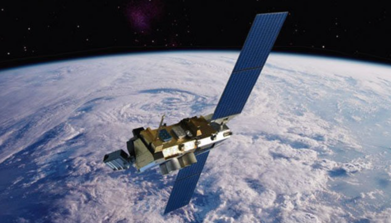
Spaceborne observation is not just for James Bond-style international spy and counterterrorism operations…It also applies to the monitoring of small surface movements on Earth; the kind of movements that construction and property companies really need to know about. That’s why we at Generali Global Corporate and Commercial (GC&C) recently launched a strategic partnership with NHAZCA (Natural Hazards Control and Assessment), a spinoff company from the Sapienza University in Rome.
This is a story about adding value beyond the policy, providing the bridge to safer and more sustainable business particularly for construction and property clients. Ultimately, it’s about providing complete and more advanced risk engineering solutions to the most critical and complex risks.
To build the best, you need the best techniques and technologies. And it’s through truly partnering with our clients – through speaking their language and understanding their sophisticated insurance needs – that we at GC&C have now come to leverage NHAZCA’s expertise in aerial and terrestrial remote sensing services, leveraging on the Satellite Advanced Differential SAR (Synthetic Aperture Radar) interferometry technology to control and minimise construction and property risks.
This technology is based on microwaves and offers a more detailed image in terms of displacement resolution (with shifts of just a few millimetres) than standard optical satellite images, without being hindered by problems related to weather conditions, such as clouds or illumination (day/night). Historical data recorded by the satellites during their orbital life also offers a dynamic picture of how risks have been evolved over time, like a real “time machine”.
How it works
Satellite SAR interferometry is a technique for mapping ground deformation using radar images of the Earth’s surface that are collected from orbiting satellites. It originated in the 1950s as a tool for airborne military reconnaissance.1 From 1992, it became substantially available for civil scopes with European Space Agency (ESA) satellites. Then from 2000 onwards, the technology was developed for industry applications.
Unlike visible or infrared light, radar waves can penetrate most weather clouds and are also effective in darkness, so they can track ground deformation even in bad weather and at night; particularly useful during a volcanic crisis.2
By bouncing signals from a radar satellite off the ground in successive orbits and looking at the differences between the images, satellite SAR interferometry can detect small differences in the distance between its position and the ground as the land surface moves – whether up, down or sideways.
Beyond geoscience
It shows spatial patterns of deformation with millimetric accuracy and, in combination with ground-based monitoring and geo-hazard risk analysis based on geotechnical expertise, can give unprecedented insights into the structural conditions of land portions or large infrastructures in terms of risk exposures.
Moreover, the risk analysis can also recover and analyse the sites’ status and its evolution over time thanks to the historical data recorded by the satellites, thereby providing the insurer with a complete data-based and time-based picture.
No other technology, not even GPS stations, could produce such a comprehensive survey over such wide areas.
Advanced risk management
As referenced earlier, satellite images have been available for decades, but it’s only recently with advances in big data and data analytics that solutions also for the insurance industry have been found.
NHAZCA enjoys a decade’s worth of experience and expertise. It is now recognised as an international leader in the analysis and monitoring of natural hazards and large infrastructures for the management and mitigation of risks. Its team consists of specialist geologists, engineers, project managers and technicians from both the private and academic worlds.
Our partnership with NHAZCA will enhance our existing technical capabilities in underwriting, risk engineering and loss prevention and claims management.
How GC&C is applying this technology
Underwriting and risk engineering can leverage on the satellite risk analysis to improve risk management activity, particularly in complex or difficult situations. For example, for large construction projects, as a complement to the traditional loss prevention service.
There are basically two ways to engage this technology from an insurance perspective: a deep dive analysis of the specific risk under evaluation (i.e. building, civil infrastructure such as a bridge, viaduct, tunnel, dam, large industrial plant, railway, port); or a wider geo-hazard risk assessment of the natural landscape to detect risks of subsidence, landslide or flood, with millimetric precision in terms of detection of movements.
Satellite risk analysis is very important for underwriters to define coverage terms and conditions and pricing. Moreover, this technology can also be useful in claims caused by earthquakes because it allows for the evaluation of the real area affected by telluric waves. Here, accurate underwriting is wholly reliant on extensive risk analysis, which is not a challenge for satellites. Traditional natural catastrophe modelling using remote sensing terrestrial analysis might, however, fall short.
This technology, as explained, can be beneficial also for claims management, allowing an accurate analysis of construction claim causes based on the comparison between the past and post claim situation. This gives an important added value to claims management in terms of technical insights, leveraging on objective and reliable information provided by satellites. This information could be ultimately considered in a legal judgment as proof of evidence for the original claim cause.
The Satellite SAR (Synthetic Aperture Radar) Interferometry technology can be considered “a powerful means by which to move throughout the geographical space in the present and the past” and this reinforces substantially our client relationship as a lifetime partner, reducing risk volatility and exposure thanks to the additional information received by satellites.
This might seem like future-gazing. But it’s more a case of the new reality coming running towards us. What may appear to be part of the future is instead a real opportunity and soon it will become the usual way of working for insurance companies and their most loyal clients.
Sources
1 Science, Fleets of radar satellites are measuring movements on Earth like never before, Feb 2021 https://www.sciencemag.org/news/2021/02/fleets-radar-satellites-are-measuring-movements-earth-never
2 Science for a changing world, Satellite-based technique captures overall deformation “picture” [Accessed April 2021] https://www.usgs.gov/natural-hazards/volcano-hazards/insar-satellite-based-technique-captures-overall-deformation-picture